Once complete, the trail will begin in historic Vallejo’s Ferry Terminal (linking with the greater Bay Area), and will continue north for 47 miles, through the world-renowned vineyards and towns of Napa Valley, to its northern gateway in Calistoga at the Oat Hill Mine Trail (Hwy29/ Silverado Trail) at the foot of Mount St. Helena.

Overseeing the trail’s development is the The Napa Valley Vine Trail Coalition (NVVTC), a grass-roots nonprofit with a vision to build a walking/biking trail system to connect the entire Napa Valley–physically, artistically and culturally. The organization is supported by a tremendous amount of hard work, including 29 board organizations and individuals representing a broad spectrum of Napa and Vallejo communities and a strong volunteer force.
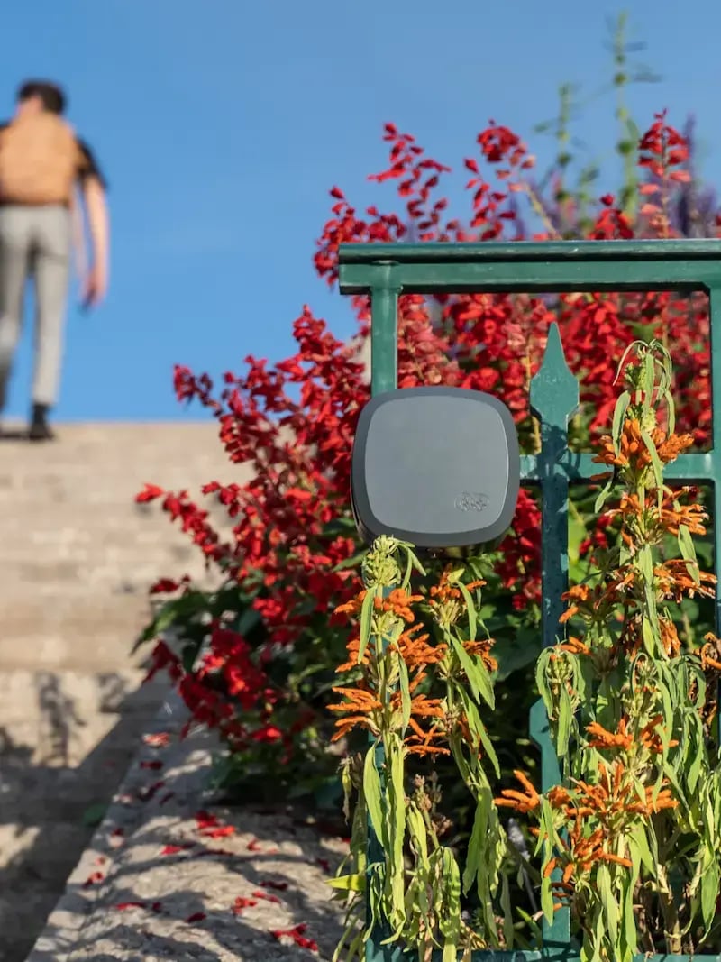
To support the project’s development, the NVVTC relies on a network of 3 permanent, MULTI counters which are able to count and differentiate pedestrians and cyclists along the route, in addition to recording direction of travel. With the sensor housed in a discrete wooden post, the counter blends into the beautiful surrounding landscape.

For the NVVTC, count data from automated bike and pedestrian counters is an essential tool for justifying investments, informing planning, and preparing for the future.
Grant applications, annual reporting and project justification
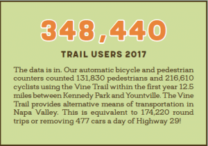
In 2017 alone, 348,440 trail users were counted on the completed 12.5 mile section of the Vine Trail between Kennedy Park and Yountville. Of those users, pedestrians make up 39% of total trail users, and cyclists 61%. These figures are used to communicate the success of the trail with local stakeholders, such as in annual reporting, and are essential for the Coalition to demonstrate just how popular the trail is when preparing grant applications.

Understanding trail use and communicating on congestion
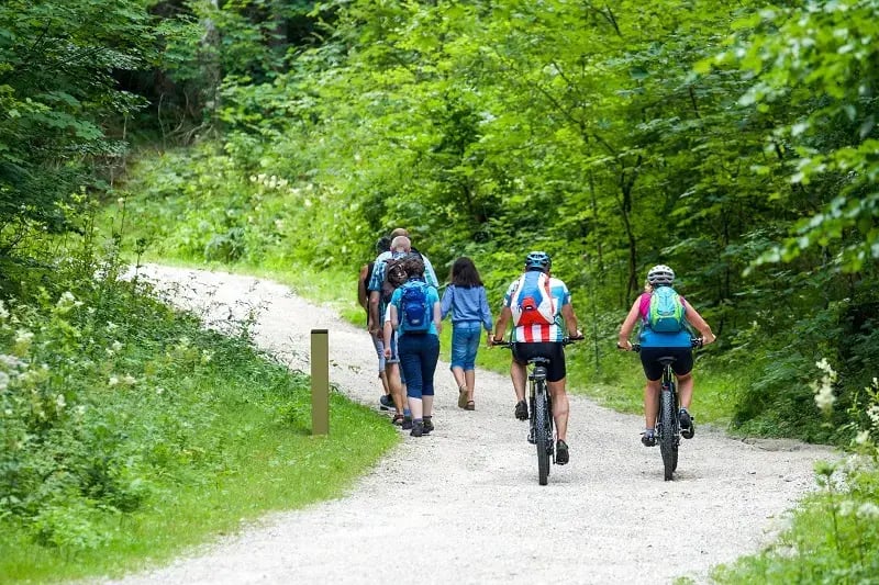
In the Napa Valley and surrounding area, congestion and vehicle traffic is a significant challenge for both locals looking to get around and visitors accessing tourist sites. Using a combination of intercept surveys and count data, the Trail Coalition were able to get a better understanding of who was using the trail and what impact this had on reducing local vehicle traffic. In a survey, trail users were asked where they were from, whether their use was for recreation of transportation purposes and if the trip was replacing vehicle use. Using count data from the automated multi-use counters, volunteers were able to scale up the data to capture just how many vehicle trips were avoided thanks to the trail!
Source: Napa Valley Vine Trail 10 Year Report
Data to inform regional planning policies
Earlier this year, the Napa Valley Transportation Authority (NVTA), in collaboration with Toole Design Group, drafted the Napa Countywide Bicycle Plan, which seeks to adopt a data-driven process to improve the bicycling environment for all residents and visitors in the area by identifying key infrastructure, programs and policies. The Napa Valley Vine Trail Coalition provided input into the plan’s development. The NVVTA provided count data from automated counters along the Vine Trail to inform this data-driven approach to transportation planning and justify the need for greater investment in a safe cycling network.
“The count data is really inspiring. The way the information is presented (in Eco-Visio) – by day of week, user, busiest day – is so well and professionally presented.”
– Maureen Gaffney, Interim Executive Director at Napa Valley Vine Trail Coalition
Planning for the future
With nearly 30 more miles of trail planned over the next few years, the Coalition have big plans and big ideas. Automated counters, for example, will allow the NVVTC to capture the impact of new infrastructure and justify capital expenditures. Similarly, trail managers will be able to assess the impact of new trail sections on existing parts of the trail to answer questions such as: do users prefer one section of the trail over another? How do users access, move along, and exit the trail? Is the new trail section attracting a greater number of visitors to the area overall?
Finally, in the future, more in-depth, targeted intercept surveys will allow the coalition to gain a deeper understanding of the trail’s positive impact on the surrounding area. A broadened survey – for example asking residents among other things what vineyards they have visited, their total trip expenditure or whether it is a multi-day trip – will allow for economic impact studies to communicate with local tourism agencies and foster greater buy-in by local businesses.

The future, much like the California sun, is bright for the Napa Valley Vine Trail. Through hard work and dedication, staff and volunteers have turned a dream into reality in a short period of time. We are proud to work with the NVVTC and are thrilled to see how automated trail counters are a central piece of the puzzle in making it all happen.
To learn more about the NVVTC, visit their website: https://www.vinetrail.org/