Monitoring the effectiveness of a summit restoration project (Acadia National Park)
Located in Maine, Acadia National Park is one of the most popular national parks in the United States. Covering over 47,000 acres, it offers national and international visitors a variety of trails, mountains, wildlife, and more to explore year round.
Mount Sargent and Penobscot Mountain are two of the park's most popular destinations for hikers. Over the years, both summits have been subject to trampling and vegetation degradation.
In response, in June 2023, 72 volunteers took part in a project to restore worn down “social trails” on the two peaks to reinvigorate plant growth.

A climate adaptation scientist at the Schoodic Institute drops off a bag of soil at the summit of Sargent Mountain during the Save our Summits hike. (Photo: Sam Mallon/Friends of Acadia)
Once the project was completed, Acadia asked: how could they ensure that the restored plots of soil remained intact?
In a study conducted with the University of Maine, the Friends of Acadia combined field data from permanent counters and survey data to answer this question.
The data helped them understand:
-
-
Overall visitor numbers and long-term trends, which helped predict how much maintenance the plots would need
-
When people disturbed the restoration plots on a daily basis, so they could send staff to check on them
-
To raise visitors' awareness of the trail restoration work underway, they placed QR codes on educational signage in the areas concerned. By comparing the number of QR codes scanned with the number of visitors, they also found out what percentage of people had read about the preservation initiative.
This data indicated if they needed better signage or communication campaigns to make sure people were letting the plots regrow.
Using data to validate the effect of ecological awareness activities (Miribel Jonage Park)
For over 40 years, the Segapal organization has been managing the Grand Parc Miribel Jonage, located between the south of the Ain department of France and the Lyon metropolitan area. This 5340 acre park is a leisure and recreation area, a drinking water reserve for 95% of the Lyon region, and a site of exceptional natural heritage.
Segapal is responsible for managing and promoting the site. In an effort to fulfill it's federal public service contract, it equipped the park with a network of permanent and mobile counters to analyze the site's activities. In particular, the counters measure attendance at the L'Iloz' environmental education center.
Visits to the L'îloz' environmental education center
Installed in the east of the park in 2015, the L'îloz' educational center is monitored by a PYRO counter, which gives visitation trends. In addition, a SLABs counter is installed on the park's peninsula, where visitor education and awareness activities are regularly held.
The peninsula is separated from the parking lot and the relaxation areas, which makes it easy to count visitors to the location. Thanks to previous data (the site has been equipped with a SLABs counter since 2006), it is possible to measure the trend of people visiting, which peaks in mid-summer.
With the goal of spreading the use of the site throughout the year, the data collected validates the effect of ecological awareness activities (observation of migratory birds, beavers, etc.) held during off-season, which help reduce the summer peak and the associated human pressures on the environment.

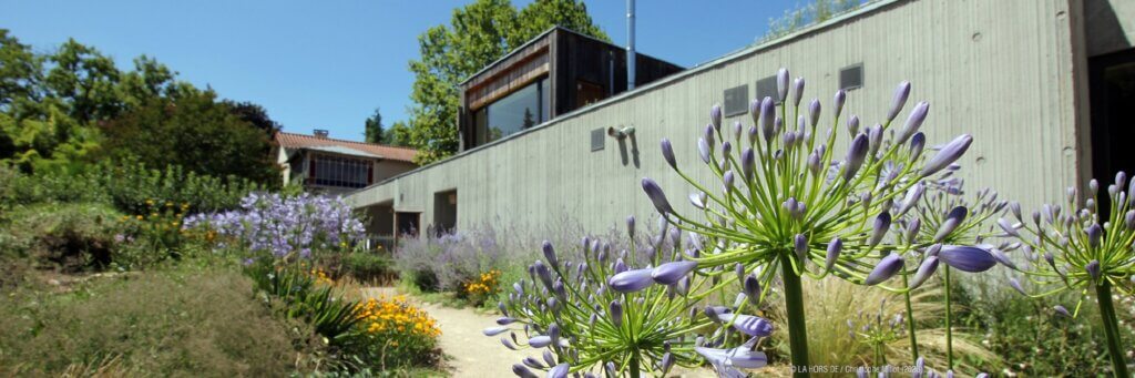
The L'îloz' environmental education center in Miribel Jonage Park. (Photo credit: LA HORDE DE / Christophe Millot)
Understanding of visitor numbers for a novel approach to education and awareness (Métropole du Grand Lyon)
To manage and preserve its "Espaces Naturels Sensibles" (ENS), the Greater Lyon Metropolis called on Euroêka Marketing to carry out an in-depth survey in 2016.
A methodology of cross-referencing qualitative and quantitative data was used.
The qualitative survey was administered on 12 nature trails and 2 hiking trails by interviewers. Reminder telephone checks were carried out for 10% of all surveys. A total of 1,001 questionnaires were administered.
At the same time, Eco-Counter installed 12 counters on the same nature trails to gather quantitative data.
By combining quantitative and qualitative data, the Lyon Metropolis was able to fine-tune its awareness-raising campaigns.

Signage evolution
For example, the Lyon Metropolis' understanding of visitor profiles had led to a reduction in the volume of signage on trails. At the same time, they increased the frequency of updates in response to their discovery that citizens visited trails 1.4 times per week on average.
A game for families
By analyzing visitor numbers, the managers of the natural areas in the Lyon Metropolis were also able to see an under-representation of young people and families among trail visitors. A specific project in the form of a treasure hunt (“The Valley of the 7 Sacred Stones" on the Voyageur Pebbles trail) had been developed to introduce natural areas to a population that was previously far removed from them. In the form of kits to be purchased from tourist offices and other sales outlets in the area concerned, families could now discover the trails in a fun way.
By way of example, the data revealed a 40% increase in visitor numbers following the opening of the “Jeux de regards” trail. The data collected can also be used to rationalize the impact of a new trail opening on visitor numbers, particularly among local residents.

The Valley of the 7 Sacred Stones game. (Photo credit: Mairie de Craponne)
Conclusion
To conclude, visitor education and awareness campaigns rely on the dissemination of relevant information. This information is most effective if it can make an impact with the public, either factually or emotionally, to form positive habits and raise awareness.
As the previous examples show, count data can play very different roles: upstream to measure existing conditions, and downstream to validate the relevance of operations carried out (awareness-raising, restoration, etc.).