Whose street is it anyway – A cordon count spatial study of Montreal’s Plateau-Mont-Royal borough
Whose street is it anyway – A cordon count spatial study of Montreal’s Plateau-Mont-Royal borough
Published Mar 1, 2024
Urban areas
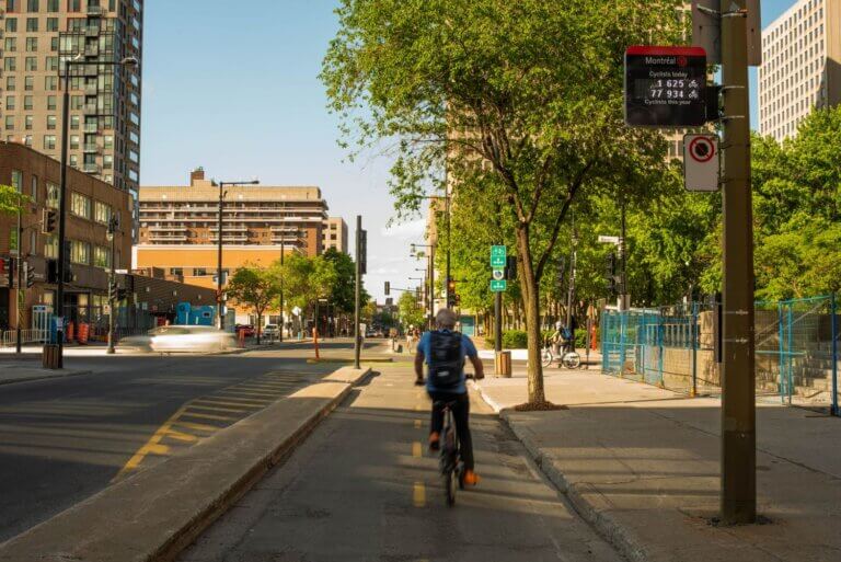
Designing facilities for active mobility is no easy task. More than ever, it requires a great deal of information and expertise to make the right decisions. For example: How wide should a pedestrian crossing be? How much should a bike path curve? How fast should people be allowed to go, and should users flow both ways?
These seemingly technical questions actually raise the issue of how to share public space fairly between modes.
They raise questions like:
How do people get around in my city today?
Are my facilities and their associated layouts fair when compared to actual usage?
Should cities be designed for the users we have today, or for those we’d like to have tomorrow?
On all these subjects, discussions can be challenging and involve multiple stakeholders: local residents, shopkeepers, associations, motorists, cyclists, pedestrians, etc.
But, there’s no better way to find the right answers than by using concrete, real-world data!
Here are a few thoughts on infrastructure sizing, with supporting data.
Subscribe to our blog
AUTHOR
Raphael Chapalain
SHARE:
Product suggestion
CITIX range
CITIX-AI Evo
An artificial intelligence traffic monitoring solution for multi-modal environments.
Ce produit sera supprimé de votre liste d’intérêts. Souhaitez-vous continuer ?
AnnulerEnlever de ma liste
Fait ! Cette solution est à présent dans votre liste d’intérêts