.webp)
To support this transition, the Àrea Metropolitana de Barcelona (AMB) has made the completion of its metropolitan cycling network, known as Bicivia, a strategic priority. The objective is not only to extend cycling infrastructure, but to ensure that routes are continuous, safe and intuitive for daily trips between neighbourhoods, municipalities and transport hubs.
Over the past five years, cycling and personal mobility vehicles have shown sustained growth across the metropolitan area. According to data published by the Àrea Metropolitana de Barcelona, bicycle use increased by 29% between 2019 and 2024, reaching an average of 14,057 daily trips in 2024.
This growth is closely linked to the progressive deployment of the Bicivia metropolitan cycling network. Covering 367 kilometres and connecting municipalities across the metropolitan area, the network has become a key backbone for sustainable mobility. The latest AMB figures report a 21% increase in demand between 2019 and 2024, with an average of 75,600 daily users last year.
These trends provide essential context for understanding why continuity, capacity and monitoring of cycling corridors have become strategic issues at metropolitan scale.
In 2025, a new round of metropolitan funding (3,38 M€) was launched to help municipalities close critical gaps in this network. Behind these investments lies a simple question: how can public authorities make sure that new corridors actually respond to real mobility needs?
.webp?width=1600&height=1066&name=image(45).webp) Credit photo : AMB
Credit photo : AMB
1. Challenge
Before systematic counting was deployed at metropolitan scale, decision-making around cycling corridors relied largely on local diagnostics. Each municipality had its own perception of where cycling was growing, where safety issues were concentrated, or which missing links should be addressed first. While this local knowledge was valuable, it remained fragmented and difficult to compare across the metropolitan territory.
At the same time, the ambition of Bicivia required a very different perspective. A corridor that seems marginal at the scale of one municipality can in fact play a critical role in connecting residential areas to employment zones, universities or major transport hubs when viewed as part of a larger network. Without shared, objective data, prioritising these “key links” remained complex.
This lack of a common factual reference also created risks. Investments could focus on visible or politically salient sections rather than on corridors that truly supported daily mobility. Measuring the impact of completed projects was equally challenging, limiting the ability to demonstrate the value of public spending or to adjust strategies over time.

Solutions
To address these challenges, the AMB progressively structured a metropolitan measurement system for active mobility, designed to integrate seamlessly with its existing digital infrastructure.
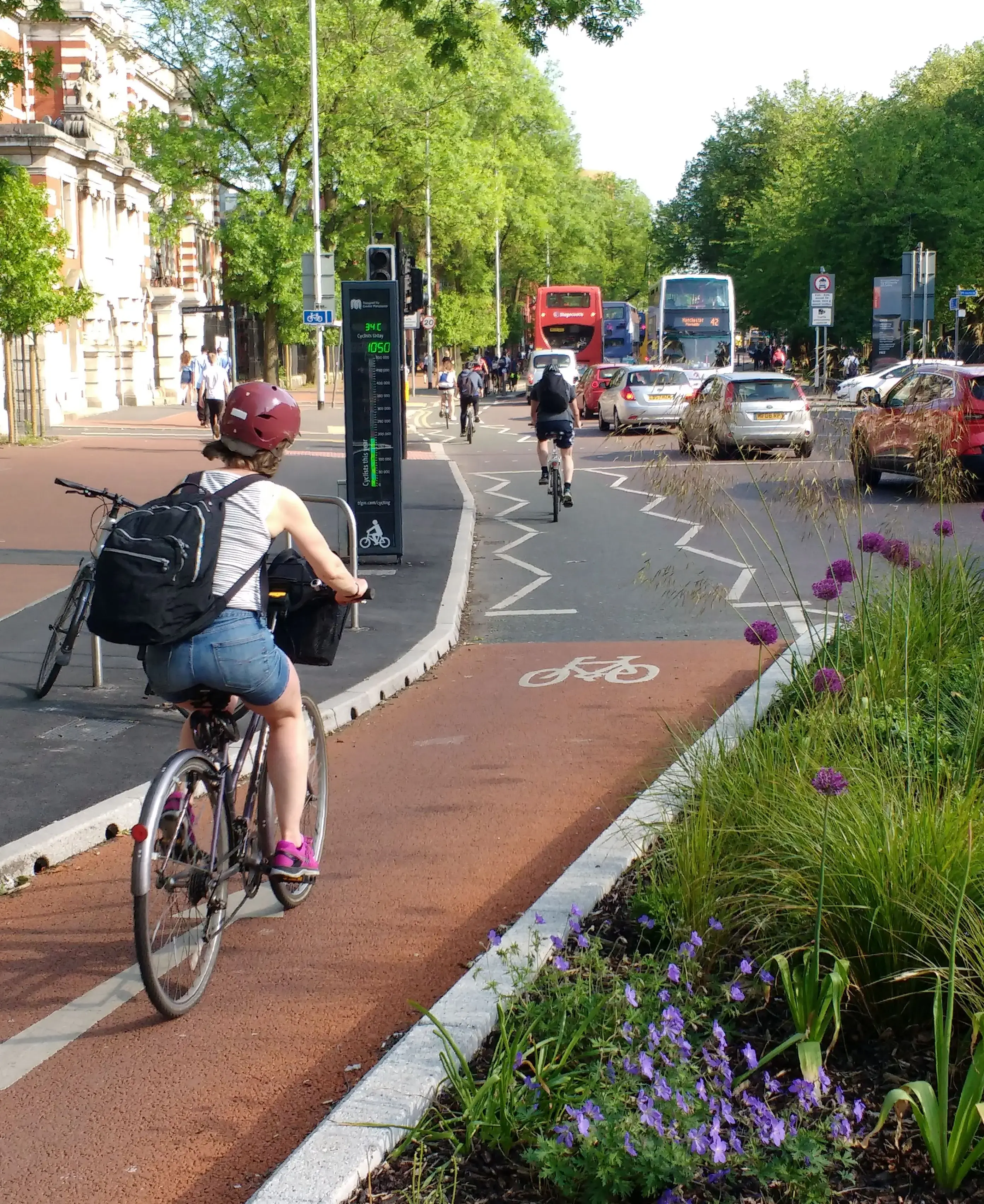
Across the metropolitan area, 53 ZELT counters were installed on cycling and pedestrian routes within different municipalities. These locations were selected to capture flows on strategic axes of the network, particularly where continuity between municipalities or access to key destinations was at stake. On several sites, display panels were also installed, making cycling and walking flows visible in the public space and helping to raise awareness of everyday use.
Rather than treating counting as a standalone exercise, the AMB chose to fully integrate these measurements into its urban data ecosystem. Using Eco-Compteur’s API, all counting data is transmitted automatically and continuously to the metropolitan platform used to manage and share urban data across services and municipalities.
This integration allows active-mobility data to be analysed alongside other metropolitan datasets and ensures that it can be accessed, compared and reused by technical teams over time. The result is a consistent series of pedestrian and cyclist counts, structured by hour, day and season, and comparable across multiple locations.
.webp?width=1600&height=1131&name=image(47).webp) Map of cycling capacity in Barcelona - Source : Movactiva
Map of cycling capacity in Barcelona - Source : Movactiva
Outcomes
What the data revealed ?
Aggregated data highlights differences in usage across the metropolitan cycling network.
Counting, monitoring, crossing et analyzing data makes it possible to observe significant variations between corridors, with some segments showing higher volumes and more regular temporal profiles than others. Hourly and daily patterns also reveal clear contrasts between weekdays and weekends, pointing to differentiated uses depending on context and corridor function.
At metropolitan scale, aggregation through Sentilo therefore provides a network-level reading that goes beyond local observation and helps identify segments with a potentially structuring role.
.webp?width=1024&height=683&name=image(48).webp) Credit photo : AMB
Credit photo : AMB
Decisions and actions enabled
These insights provided a concrete basis for prioritizing investments within the metropolitan funding programme. Rather than focusing solely on infrastructure length or local demand, funding decisions could take into account real usage patterns and the role of each segment within the wider network.
For municipal technical teams, access to shared data helped align local projects with metropolitan objectives. For elected officials, the measurements offered a clear and objective way to justify investments and to communicate their impact. Over time, the same data also provides a reference to monitor how completed corridors perform and how usage evolves once continuity is restored.
The presence of Eco-DISPLAYs in public space added another dimension, making cycling flows visible and tangible for residents and reinforcing the perception of cycling as a normal, everyday mode of transport.
4. Learnings
This experience highlights a key lesson for large urban regions: metropolitan cycling policies require metropolitan data and the capacity to analyze them. When counting is organised, interoperable and shared across municipalities, it becomes possible to move from a collection of local projects to a coherent network strategy.
It also shows that interoperability matters as much as measurement itself. By integrating active-mobility data directly into an existing urban data platform, the AMB ensured that cycling counts became part of everyday decision-making, rather than a separate technical exercise.
Conclusion
As Barcelona’s metropolitan area continues to invest in cycling infrastructure, data plays a quiet but decisive role. By revealing how people actually move across municipal boundaries, it helps public authorities focus their efforts where they matter most: on the corridors that turn fragmented bike lanes into reliable, everyday routes.
In this context, counting is no longer just about measuring volumes. It becomes a tool for building trust, aligning stakeholders and making metropolitan mobility strategies both visible and actionable.